The Built Environment as Historical Witness: Analyzing Istanbul's 1960 Housing Landscape Through the Lens of Contemporary Vulnerabilities
In the wake of recent seismic activity—both political and geological—Istanbul's historical housing trajectory reveals patterns we can no longer afford to ignore.
Prologue: Between Political Tremors and Tectonic Shifts
Following the political intervention of March 19, Istanbul experienced on April 23 what many fear to be a harbinger of the long-dreaded major earthquake—a 6.2 magnitude seismic event off the coast of Silivri. Istanbul is, if nothing else, a city of remarkable resilience. Having devoted years to its study, and having spent half my life in this metropolis since returning from the United States, I continue to contemplate its complexities with undiminished intellectual fervor.
As I have argued in numerous publications and forums, Istanbul's contentious relationship with seismic vulnerability fundamentally derives from the problematic nature of its housing stock ab initio. This housing predicament began to manifest with particular clarity in the mid-1940s, establishing patterns of spatial development whose consequences reverberate into our present moment.
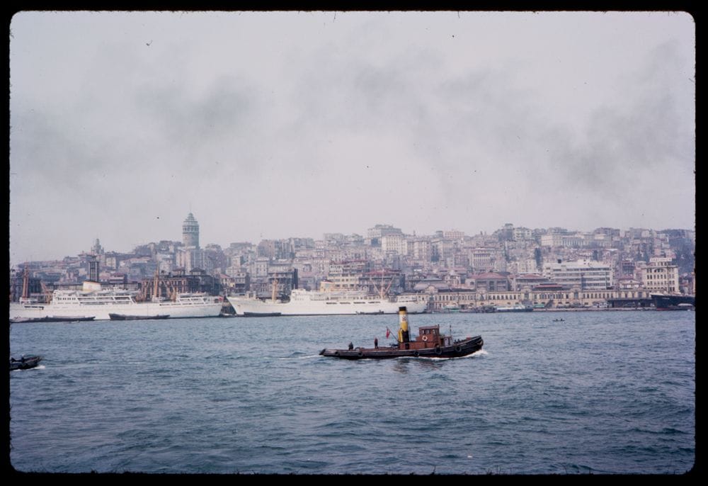
Below, you can find the results from a comprehensive research conducted in the second half of 1960 and published in 1962 - which I believe was carried out by the team that laid the foundations of the State Planning Organization and the State Statistics Institute - reflecting its findings from the Istanbul sample. I couldn't add the statistical details because I don't have the complete text with me. The visualization below is the product of a month I spent in the State Statistics Institute library in Beşiktaş in the early 2010s.
Istanbul Housing Survey | 1960
A comprehensive visualization of Istanbul's housing landscape in the mid-20th century
Total Housing Units
303,418
Occupancy Rate
98.21%
Renter-Occupied
58.24%
Owner-Occupied
38.59%
Home Ownership Status
Room Distribution
Size Distribution (m²)
Commuting Methods
Building Types by Percentage
Building Types by Count
Building Types by Occupational Category
With Electricity
95.09%
With Kitchen
80.49%
Private Toilet
87.74%
With Bathroom
45.55%
Basic Amenities
Utility Connections
Heating Types
Sewage Systems
Housing Units by Occupation
Tenure by Occupation
Housing Amenities by Occupation
My research indicates that the first active migrant gecekondu settlements—a term denoting informally constructed "built overnight" housing—began to emerge outside the Yedikule area -around the old Golden Gate of the Theodosian Walls- in what is now the Zeytinburnu district during the mid-1940s. This is not to suggest that informal settlements were entirely novel phenomena in Istanbul's urban landscape. Indeed, earlier gecekondu neighborhoods had concentrated in more historically established districts of the city.
We must remember that at the beginning of the 20th century, as the Ottoman Empire was entering its terminal decline, catastrophic fires destroyed approximately half of Istanbul's predominantly wooden housing stock. One could reasonably characterize a significant portion of the historical city's residential inventory as mere ruins—physical manifestations of imperial collapse and the material preconditions for subsequent urban transformations.
By the 1930s and 1940s, even these ruined spaces were becoming insufficient to accommodate the slow but steady waves of migration, primarily from the Black Sea region but also including earlier settlements of Balkan immigrants. The historical core appeared to have reached its absorptive capacity. By the 1950s, the primary urban contestation—as I have elaborated in previous articles—centered on these new migrants' desperate search for spaces in which to establish shelter. The struggle for habitable space became particularly acute around the 1946 elections, manifesting most visibly in land occupations in Zeytinburnu. What we would later formalize under the term gecekondu settlements began precisely at this historical juncture, intensifying between 1946 and 1950 as rural-to-urban migration accelerated.
Adnan Menderes's most significant achievement—one that would prove consequential for Istanbul's subsequent urban development trajectory—was his pragmatic response to this settlement movement. After initially turning a blind eye to these informal developments, Menderes effectively channeled the virtually inevitable migration from Anatolia after 1950 into a process that transformed landless migrants into urban property holders, however tenuous or legally ambiguous that property status might be. This political accommodation of informality established a pattern of urban development that would define Istanbul's growth for decades to come—a pattern whose material manifestations are captured with remarkable clarity in the 1960 housing inventory data.
From an analytical perspective, this transformation represents a quintessential example of what Henri Lefebvre termed the "production of space" under peripheral capitalism, wherein the state serves as mediator between demographic pressures and capital accumulation imperatives. The political ecology of Istanbul's built environment—its spatial organization, material qualities, and infrastructural networks—emerges not merely as the backdrop against which social processes unfold, but as the materialization of specific political-economic arrangements and governance strategies.
When we situate the 1960 housing data within this historical context, we can discern not merely statistical patterns but the sedimentation of political decisions, economic imperatives, and social contestations into the very fabric of the city. The preponderance of certain building types, the distribution of amenities, and the patterns of occupancy by social class reveal Istanbul at a critical historical juncture—a city simultaneously bearing the imprint of its imperial past and crystallizing the socio-spatial contradictions that would define its subsequent development under rapid industrialization and uneven modernization.
What emerges from this analysis is a portrait of Istanbul not as a city defined primarily by its spectacular monuments or cultural representations, but rather as an assemblage of ordinary spaces—apartments, detached houses, flats, and squatter settlements—that constituted the material infrastructure of everyday life for its inhabitants. These mundane spaces, captured in the 1960 housing inventory's meticulous documentation, provide a crucial archaeological layer for understanding the city's contemporary vulnerabilities to both political and seismic instability. The tremors of April 2025 reverberate not merely through geological strata but through these historical sedimentations of urban development, exposing the enduring consequences of decisions made decades earlier.
I. The 1960 Moment: Capturing Istanbul at a Critical Juncture
In examining the detailed housing inventory data from 1960 Istanbul, we confront a city in profound transition—a metropolis caught between imperial decline and nationalist modernization, between traditional urban forms and the inexorable pressures of rapid industrialization. The dataset before us represents more than mere statistical information; it offers a freeze-frame of a city at perhaps its most critical historical inflection point, just as the first major waves of rural-to-urban migration were transforming its social fabric and physical landscape.
This inventory—captured just after the 1960 coup d'état that deposed Menderes—provides a crucial baseline for understanding the subsequent trajectories of Istanbul's urban development. It illuminates, with remarkable clarity, the material conditions that would shape both the city's vulnerabilities and its resilience in the decades to follow.
II. Housing Typology and Ownership Patterns: A Socio-Spatial Reading
The visualization reveals that Istanbul's housing stock in 1960 already exhibited remarkable diversity in its typological composition. Apartments constituted 35.25% of all housing units, alongside attached houses (24.81%), flats [ev dairesi in Turkish] (23.51%), and detached houses (16.43%). This distribution reflects both the remnants of Ottoman urban morphology and the initial phase of what would later become the dominant form of speculative development through the yapsatçı system of build-and-sell construction.
Perhaps most telling is the ownership pattern, with 58.24% of units being renter-occupied against only 38.59% owner-occupied. This preponderance of rental housing speaks to the transitional nature of urban life for many residents and the emergence of a nascent urbanite rentier class—those positioned to capitalize on the desperate need for shelter in a rapidly expanding metropolis. The data testifies to what Henri Lefebvre might identify as the early stages of "the production of space" under the specific conditions of peripheral capitalism. The relatively low vacancy rate (1.79%) further indicates the intense pressure on the housing stock even before the major population explosions of subsequent decades.
III. The Infrastructure of Everyday Life: Amenities as Social Indicators
The amenities data offers a window into the material conditions of daily life—the infrastructure of domesticity—that shaped experiences of modernity for ordinary Istanbulites. The figures are striking: while 95.09% of housing units had electricity (speaking to the prioritization of modernization in Turkey's development policies), only 45.55% had bathrooms. This discrepancy between electrification and sanitation infrastructure reveals a specific pattern of uneven development that privileged spectacular modernization over quotidian necessities.
Moreover, the heating systems data—showing 94.09% of units relying on stoves and only 3.48% having central heating—illuminates both the continuity of traditional domestic practices and the socio-economic stratification of the urban population. This stubborn persistence of stove heating would later contribute to the city's notorious air pollution crises of the 1970s and 1980s—an environmental externality of incomplete modernization.
The sewage system statistics (75.97% connected to sewers, 16.99% to septic systems, and 7.04% "other"—a bureaucratic euphemism for direct discharge) presage the environmental challenges that would accompany Istanbul's expansion. These numbers represent not merely technical arrangements but the materialization of class relations and governance priorities in the built environment.
IV. Size Distribution and Room Configuration: The Spatial Politics of Urban Life
When we examine the size distribution of housing units, we encounter a stark reality: 40.55% of all units were smaller than 50 square meters, with an additional 28.29% between 50-74 square meters. That more than two-thirds of Istanbul's housing stock consisted of relatively small units speaks to both the economic constraints of the period and the spatial compression that would intensify with subsequent waves of migration.
The room distribution data adds nuance to this picture. The modal category was 3-room dwellings (24.55%), closely followed by 2-room units (23.64%). The relatively high proportion of 4-room (20.51%) and 5+ room (20.52%) dwellings, despite the predominance of smaller-sized units, suggests dense living arrangements—multiple people sharing modest spaces, a pattern that would become increasingly common as the city grew.
V. Housing by Occupation: The Materialization of Class Structure
Perhaps most revealing is the data on housing conditions by occupational category. The visualization exposes the material dimensions of class stratification in early Republican Istanbul. Self-employed professionals and technical workers, representing a nascent middle class, enjoyed significantly better housing conditions than wage earners or the unqualified. This pattern of differential access to housing amenities—particularly bathrooms and kitchens—reaffirms what the "uneven incorporation" of different social groups into modernity.
The robust representation of self-employed non-professionals (101,528 units)—constituting approximately one-third of Istanbul's occupied housing stock—necessitates a reconsideration of conventional narratives of Turkish modernization. Rather than the state-led, bureaucratically-administered development emphasized in mainstream historiography, this data suggests the vitality and numerical predominance of the "esnaf"—the myriad small-scale entrepreneurial activities that constituted the predominant mode of urban economic integration for rural-to-urban migrants.
The tenure patterns by occupation further illuminate this stratification. While self-employed non-professionals showed the highest rate of homeownership, salaried workers were predominantly renters. This suggests a complex relationship between occupational status, income stability, and property ownership that defies simplistic correlations between class position and housing tenure.
The housing conditions of the unemployed or unqualified laborers (Mesleksizler, 48,951 units) present a particularly intriguing case. This category shows a relatively high rate of homeownership (53.44%) compared to rental (45.24%)—a pattern that contradicts conventional expectations of property relations among economically marginal populations. This anomaly can be explained through what Çağlar Keyder and Ayşe Buğra have identified as the distinctive "welfare regime" of Turkish urbanism—the substitution of informal property access (primarily through gecekondu settlements) for formal social provision, functioning as what Mike Davis has termed a "safety valve" for the contradictions of peripheral capitalist development.
VI. The Commuting City: Mobility Patterns and Urban Form
The commuting data offers a fascinating glimpse into the everyday mobility patterns that structured urban life. Walking remained the predominant mode of transport (41.57%), reflecting both the compact nature of traditional Istanbul neighborhoods and the limited reach of mechanized transportation networks. The bus system (31.01%) had already emerged as a significant mode, while ferries (9.31%) continued to play an important role in this city defined by its waterways. The relatively minor role of trains (5%) indicates the still-limited development of rail infrastructure that would later become crucial to managing the city's expansion.
These mobility patterns reveal a city still operating at a human scale in many respects—a quality that would be progressively eroded by subsequent automobile-oriented development and sprawling expansion beyond the historical peninsula and its immediate surroundings.
VII. Conclusion: Reading History Forward, Reading the Present Backward
The visualization of Istanbul's 1960 housing inventory offers more than historical curiosity; it provides crucial context for understanding the contemporary vulnerabilities that both political and seismic tremors expose. The housing stock documented here—much of which still stands, modified and densified—forms the material substrate of the city's current earthquake risk profile. The building types, construction methods, and patterns of occupation captured in this data prefigure the specific forms of precarity that would intensify in subsequent decades.
The substantial representation of self-employed non-professionals within Istanbul's housing landscape illuminates what Karl Polanyi identified as the "double movement" characteristic of capitalist development—the simultaneous expansion of market relations and the emergence of protective countermovement. The predominance of this entrepreneurial category in Istanbul's 1960 housing stock prefigures what Ayşe Buğra has termed Turkey's distinctive "state-market-family constellation"—a development pattern wherein small-scale capitalist activities and familial welfare provision compensate for the limitations of both state capacity and formal market mechanisms.
In this regard, the 6.2 magnitude earthquake off Silivri on April 23 should be read not merely as a geological event but as a moment when history itself trembles—when the accumulated decisions, investments, neglects, and improvisations that produced Istanbul's built environment are suddenly and violently reassessed. The political tremors that preceded it, likewise, represent moments when the social foundations of urban order are similarly tested.
Istanbul's housing trajectory—from the gecekondu settlements of the 1940s through the apartment-building boom captured in this 1960 data and beyond—reveals a persistent pattern wherein the desperate need for shelter trumps considerations of safety, quality, and sustainability. Menderes's "success" in transforming rural migrants into urban property owners (however tenuous that ownership might be) established a paradigm of urban development that prioritized immediate accommodation over long-term resilience.
As we confront the dual specters of political instability and seismic risk in contemporary Istanbul, this historical dataset serves as both warning and guide. It reminds us that the vulnerabilities we face today were constructed over decades through specific policy choices, economic arrangements, and social compromises. Understanding these patterns is the first step toward constructing more resilient alternatives—toward building a city that might withstand the earthquakes, both literal and metaphorical, that surely lie ahead.
In the words of Walter Benjamin, "even the dead will not be safe" if patterns of historical development continue uninterrupted. For Istanbul's residents, living amidst the layered vulnerabilities of a housing stock whose origins are captured in this 1960 data, the stakes could not be higher. The visualization before us is not merely a historical document but a map of present dangers and future possibilities.